Home Experiences Group Tours Consulting Blog About Contact Plan Your Journey
EN IT ES
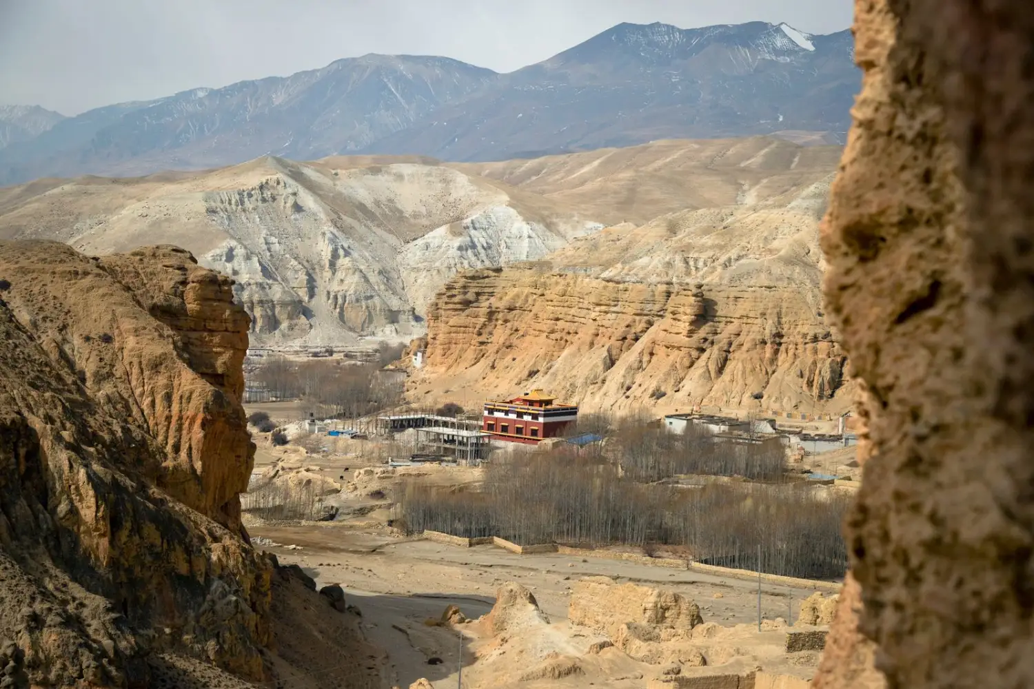
Lo Manthang valley framed by rock walls in Upper Mustang, Nepal
Ashok J Kshetri / Pexels
Trekking · Cultural · Upper Mustang

Upper Mustang Trek — Lo Manthang, Yara and Luri Gompa in 23 days

A private journey on foot through the last forbidden kingdom of Nepal: walled cities, cave monasteries and the high desert of the old Kingdom of Lo.

Duration23 days / 22 nights
FormatPrivate

The Upper Mustang trek is a private 23-day journey in Nepal, starting and ending in Kathmandu, with 15 days on foot and a highest point of about 4,200 m at the Paha Pass. From Jomsom the route climbs through Kagbeni, Samar, Ghemi and Charang to the walled city of Lo Manthang (3,840 m), then returns by a different path through Yara, the cave monastery of Luri Gompa, Tangge and the sacred temple of Muktinath. Kathmandu and Pokhara open and close the trip, with cultural visits and buffer days for mountain weather.

Often called the last forbidden kingdom, Upper Mustang stayed closed to foreign trekkers until 1992, and a special permit is still required to enter. It is a high desert of red cliffs, chortens and prayer flags, where Tibetan Buddhist life continues in villages reached only on foot or by rough track. You walk at the pace of the place, with a licensed local guide, and come back with a different sense of distance.

01
Lo Manthang, the walled city

The capital of the old Kingdom of Lo, founded around 1380, with its earthen walls, palace and painted gompas.

02
Luri Gompa and Tashi Kabum

Two hand-carved cave temples near Yara, known for their Buddhist murals, on the less walked return route.

03
Lo Gekar and the Ghemi mani wall

One of the oldest monasteries in Nepal and a mani wall about 300 m long, both bound to the legends of Guru Rinpoche.

04
Muktinath, sacred to two faiths

A temple revered by Hindus and Buddhists, with 108 water spouts and an eternal flame, below the Gyu La pass.


Day by day

Day 1 Arrival in Kathmandu
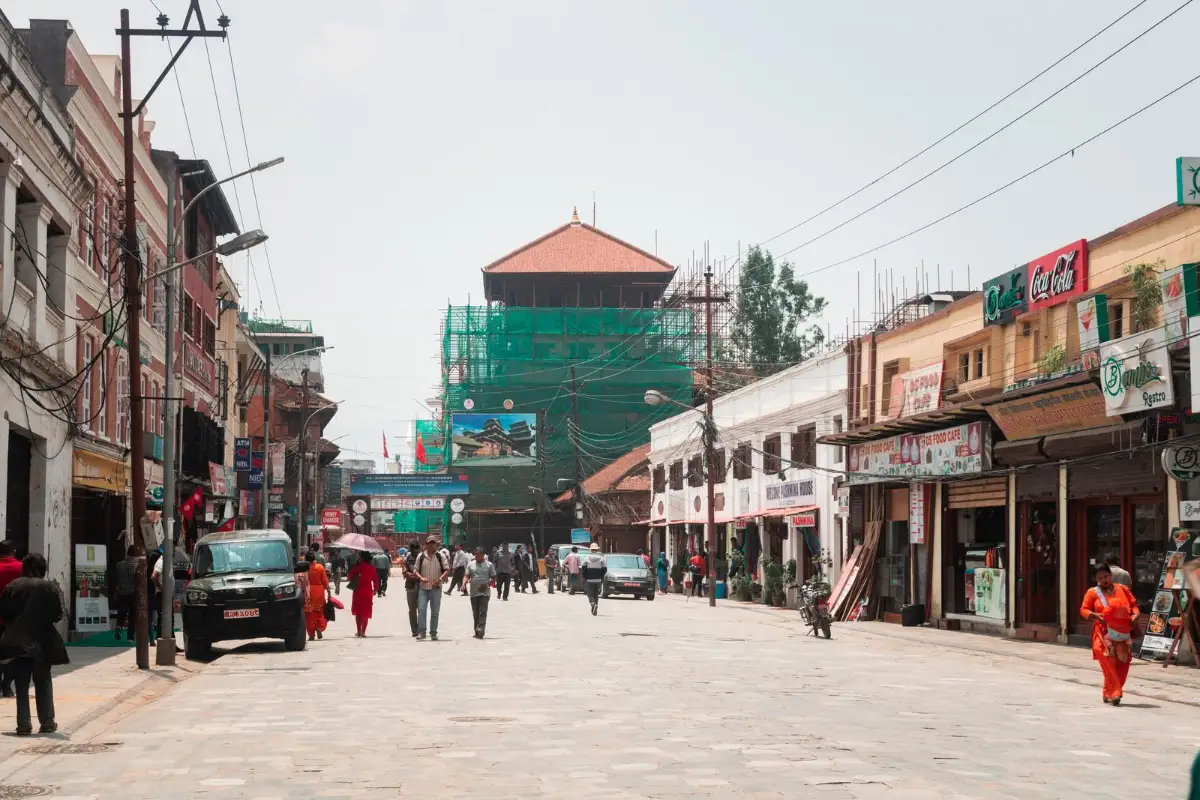
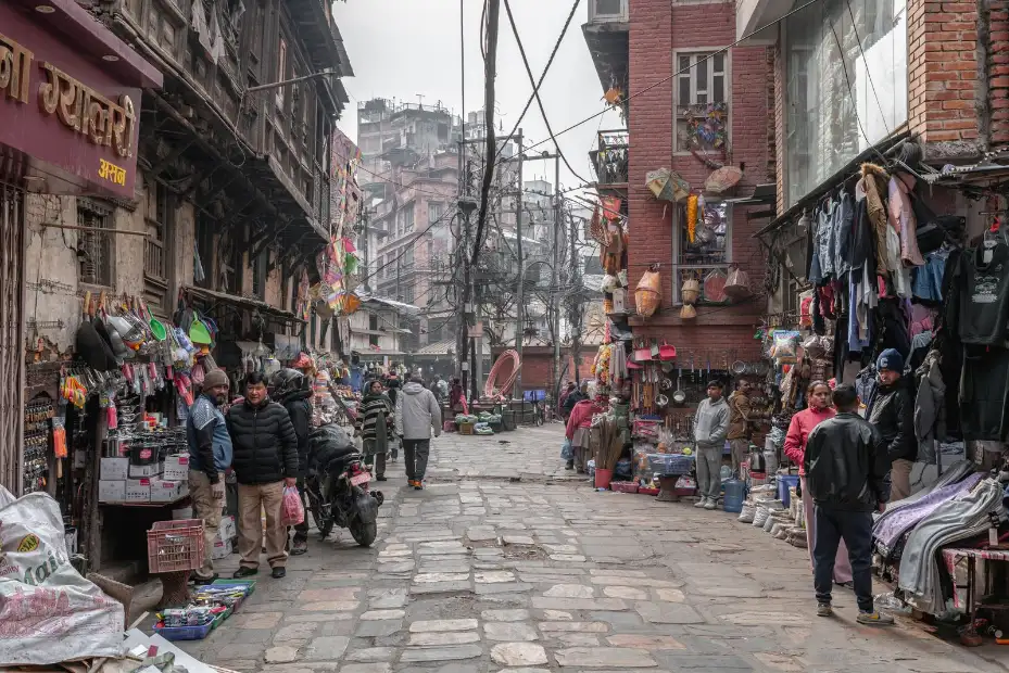
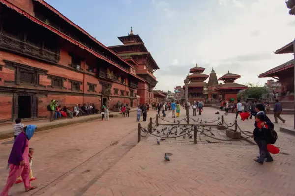
Street with shops and a tiered temple in Kathmandu, Nepal Mr Dr3igeteilt / Pexels
Welcome to Kathmandu, where the journey begins. At the airport you are met by a member of the local team and taken to a hotel in Thamel or a similar central area. First impressions come quickly: busy streets, colourful markets and a mix of cultures that changes from one corner to the next. There is no hurry today. Take time to rest after the flight, then meet for an evening briefing that walks through the trek ahead, the route and what to expect in Upper Mustang. You sleep in Kathmandu.
Day 2 Kathmandu Valley: Swayambhunath, Boudhanath and Pashupatinath
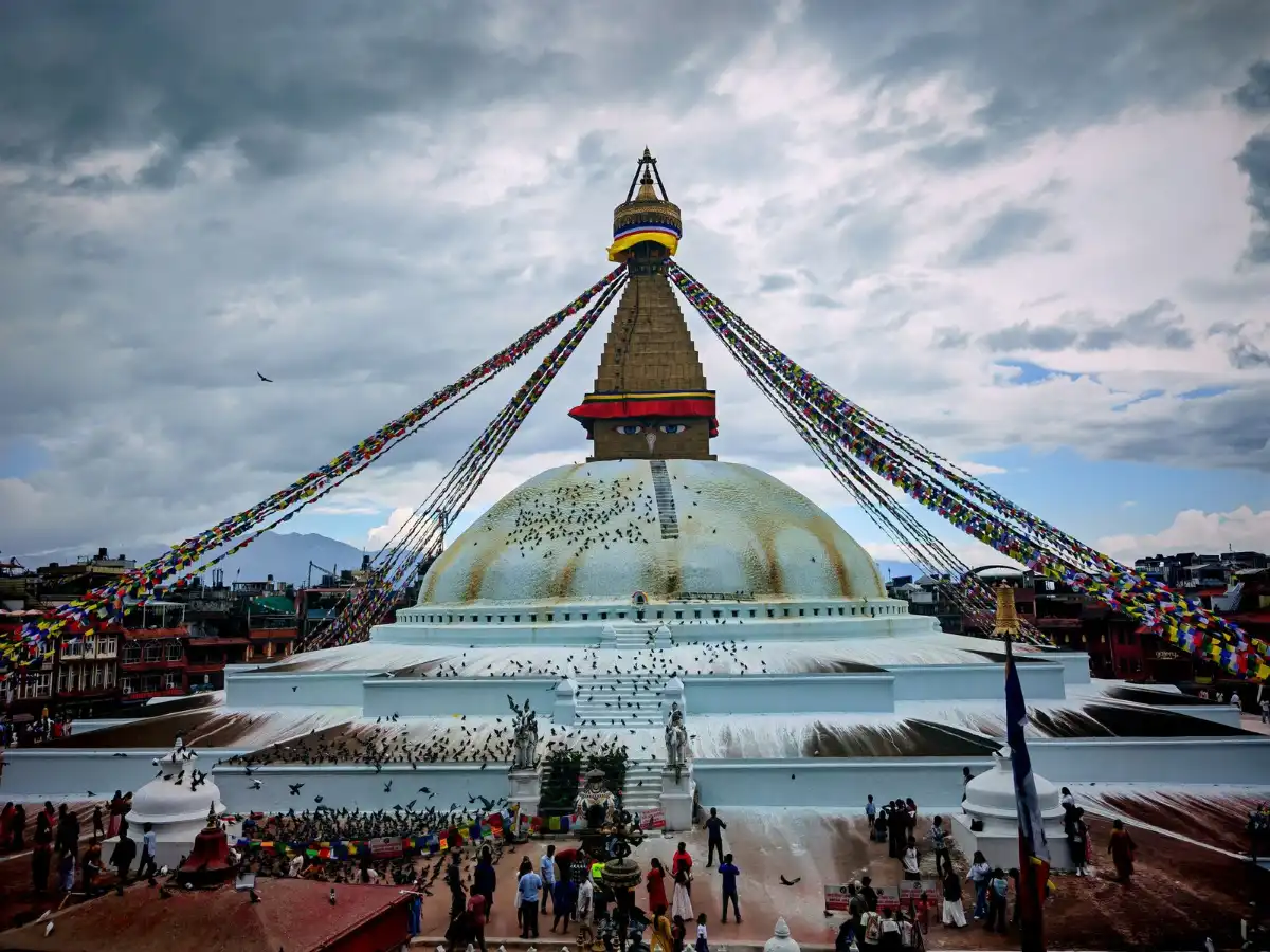
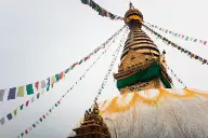
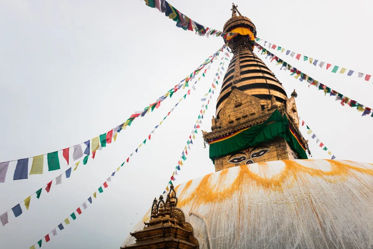
Boudhanath Stupa with prayer flags in Kathmandu, Nepal Bivek Shrestha / Pexels
A guided day among the UNESCO World Heritage sites of the Kathmandu Valley. Swayambhunath, the Monkey Temple, opens a wide view over the valley from its hilltop. Boudhanath, the largest stupa in Nepal, gathers pilgrims walking clockwise beneath its prayer flags. At Pashupatinath, the sacred Hindu temple on the Bagmati River, daily rituals unfold along the water. Depending on the day, the visit continues to the Durbar Square of Patan or Bhaktapur, with its ancient palaces and temples. Later there is time for final trek preparation and for buying any missing gear. You sleep in Kathmandu.
Day 3 Scenic drive to Pokhara (820 m)
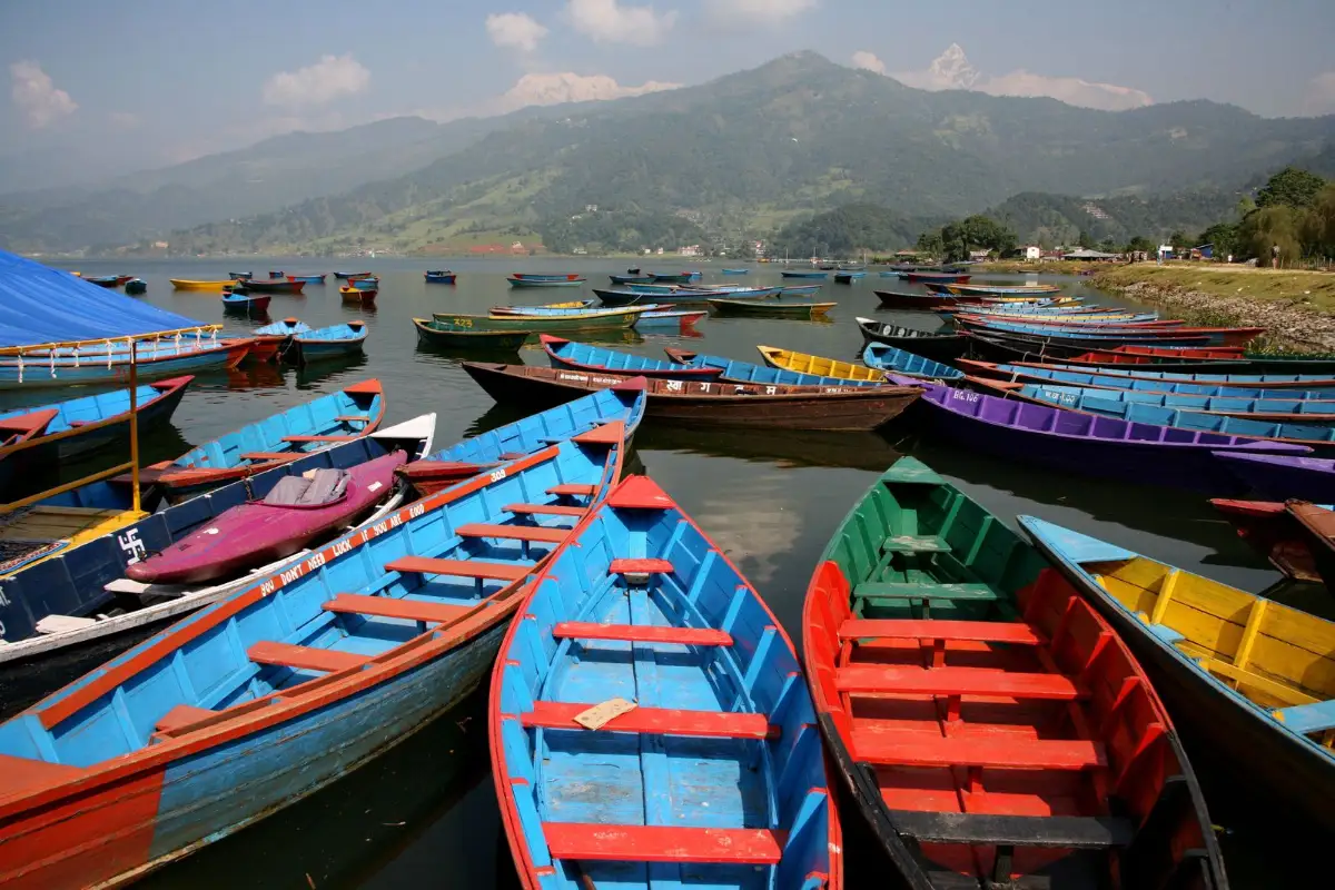
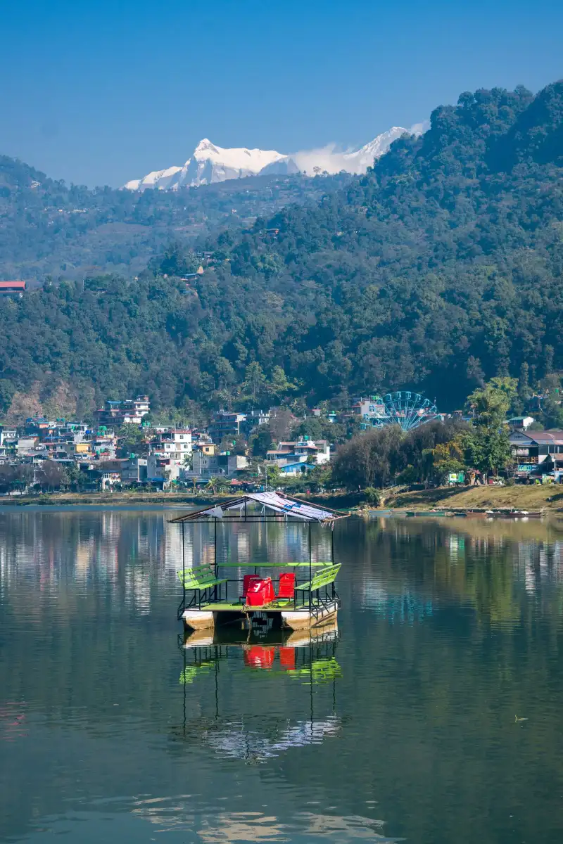
Colourful wooden boats on Phewa Lake with mountains behind, Pokhara, Nepal Jungsik Kwak / Pexels
We leave the capital by private vehicle for a drive of about six to eight hours, following the valleys of the Trishuli and Marsyangdi rivers. It is a long day on the road, and a good way to watch the landscape change as the city gives way to hills and rivers. In Pokhara, at 820 metres, the pace drops. After checking in at the hotel, take a walk along the shore of Phewa Lake, where on clear days the Annapurna range rises beyond the water. You sleep in Pokhara, ready for tomorrow's early flight.
Day 4 Flight to Jomsom (2,700 m) and first steps to Kagbeni (2,810 m)
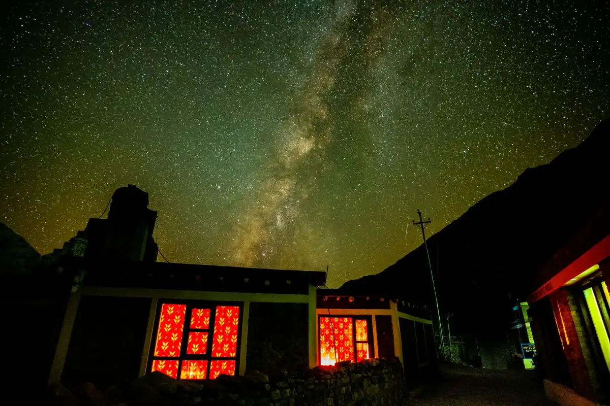
Milky Way above a traditional house in Kagbeni, Nepal Devaraj Phukan / Pexels
A short, spectacular mountain flight of about twenty minutes carries you from Pokhara to Jomsom, at 2,700 metres. Here the trek begins. We walk north along the wide bed of the Kali Gandaki River, with Tilicho Peak and Nilgiri North in view and the land growing drier with every hour. The day ends at Kagbeni, at 2,810 metres, a Tibetan-influenced village of ancient architecture that stands at the threshold of the restricted area. It is the last stop before Upper Mustang, and a gentle first day on the trail. You sleep in Kagbeni.
Day 5 Into Upper Mustang: Kagbeni, Tangbe and Chuksang (about 3,000 m)
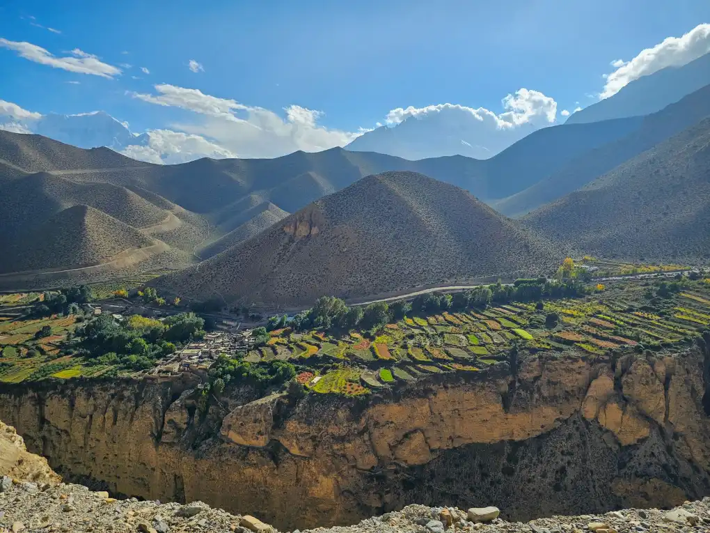
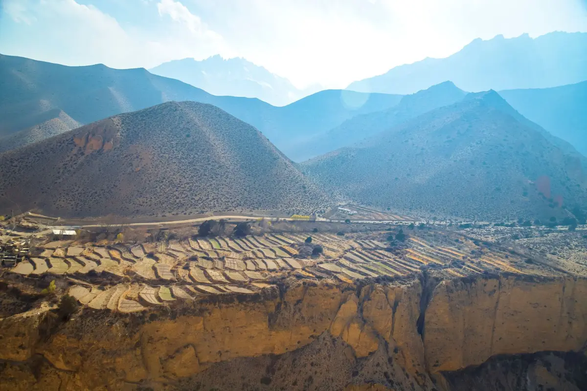
Terraced fields and mountains in the Mustang valley, Nepal Sagar Gnawali / Pexels
Today we enter Upper Mustang, a restricted zone that stayed closed to foreign trekkers until 1992. About five hours of walking lead through windy, barren terrain, and this is the first real immersion in Mustang's high desert. The stop at Tangbe breaks the day with a surprise of colour: whitewashed houses, orchards and chortens set against the dry slopes. We continue to Chuksang, at about 3,000 metres, where the valley narrows and the rock takes on warmer tones. The wind often picks up in the afternoon, so a steady pace helps. You sleep in Chuksang.
Day 6 Over Dajori La (3,660 m) to Samar
Rugged cliffs of Mustang with Himalayan peaks behind, Nepal Sagar Gnawali / Pexels
A steep climb opens the day, about four and a half hours of walking in all. It leads up to the Dajori Pass, at 3,660 metres, the first of many high points on this route, with wide Himalayan views that repay the effort. From the pass we continue to Samar, a village surrounded by red rock cliffs. With the afternoon free, you can explore the caves nearby and the Tibetan prayer walls, the mani walls whose carved stones you will meet again and again in the days ahead. Pass them keeping them on your right, as local custom asks. You sleep in Samar.
Day 7 Ranchung Cave, Syangboche and Gheling (3,570 m)
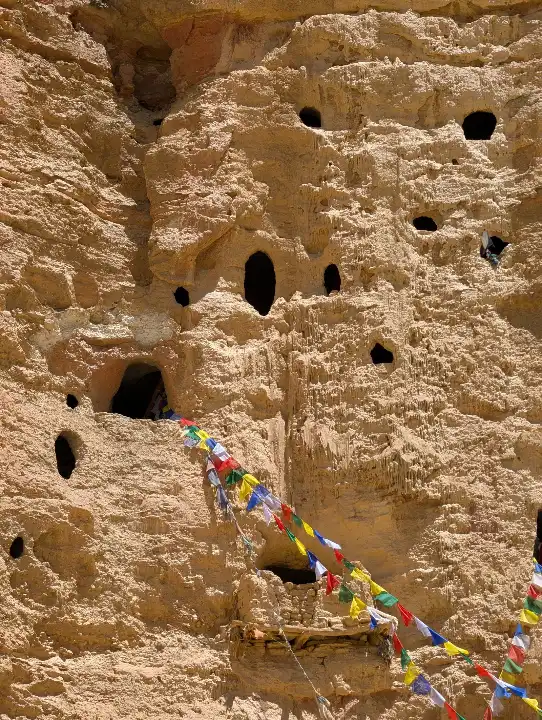
Ancient caves carved in a cliff with prayer flags, Mustang, Nepal Sagar Gnawali / Pexels
One of the longer days, with about seven hours on the trail. We stop first at Ranchung Cave, an ancient meditation site that gives a first sense of how deeply this landscape is tied to Buddhist practice. The route then crosses high passes and plateaus by way of Syangboche, with views of Annapurna and other peaks to the south. We end the day at Gheling, at 3,570 metres, a village known for its barley fields and Tibetan-style homes. After so much bare rock, the green and gold of the fields feel like a gift. You sleep in Gheling.
Day 8 Nyi La (about 3,950 m) and Ghemi (3,520 m)
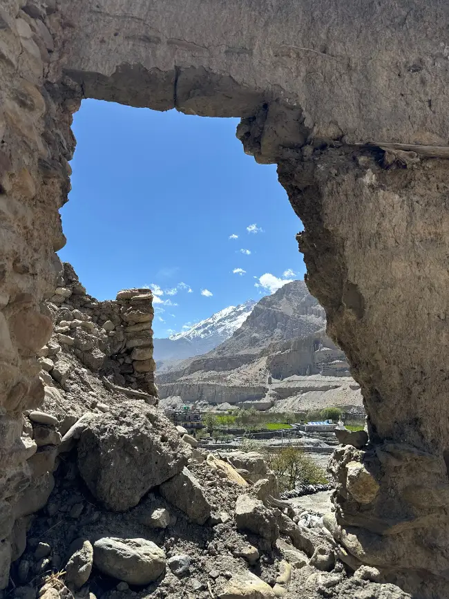
Mountains and valley framed by ancient ruins in Mustang, Nepal Prince Sanem / Pexels
A shorter walk of about four hours, with one solid climb. From Gheling we rise to the Nyi La, at around 3,950 metres, among the high points of the outward route, then descend towards Ghemi, at 3,520 metres. Near the village stands one of the great sights of Mustang: a mani wall about 300 metres long, often described as the longest in Nepal. Local legend says it formed from the entrails of a demon slain by Guru Rinpoche, whose blood stained the surrounding cliffs red. You will see why the story has lasted. You sleep in Ghemi.
Day 9 Lo Gekar monastery and the red cliffs of Dhakmar (3,500 m)
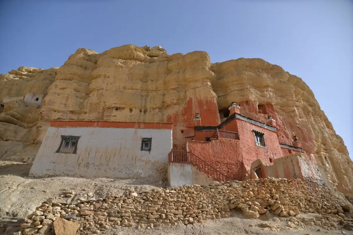
Red monastery on rocky terrain in Mustang, Nepal Sagar Gnawali / Pexels
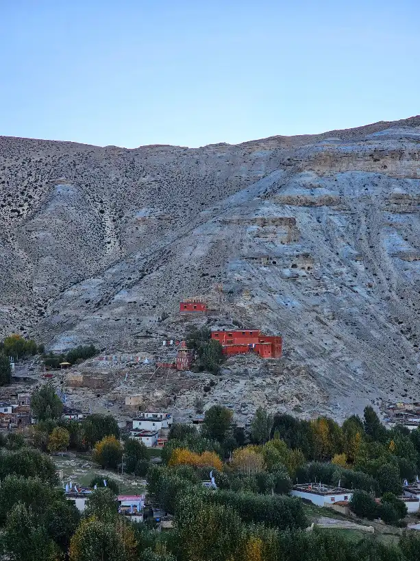
About six hours of walking bring together two of the strongest places on the route. Lo Gekar, also known as Ghar Gompa, is one of the oldest monasteries in Nepal, traditionally linked to Guru Rinpoche and the eighth century, with frescoes and clay statues in an isolated setting. We then reach Dhakmar, at 3,500 metres, beneath striking red cliffs pitted with caves. Here the legends of Guru Rinpoche seem close at hand, and there are cave gompas to explore nearby. The colour of the rock changes hour by hour, so stop often and look up. You sleep in Dhakmar.
Day 10 Canyons and plateaus to Charang (3,560 m)
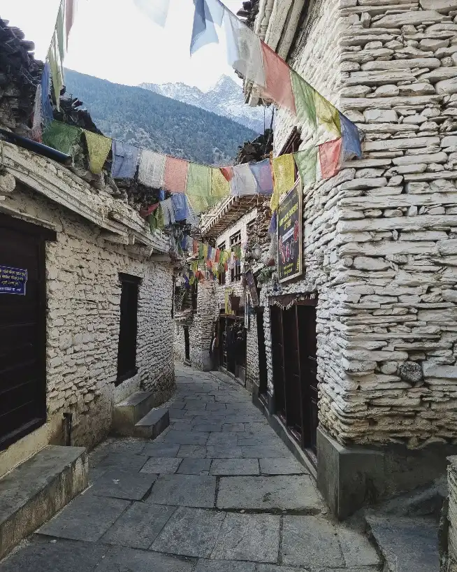
Stone alley with prayer flags in a Mustang village, Nepal BiZay Sunuwar / Pexels
About five hours through canyons and open plateaus lead to Charang, at 3,560 metres, one of the most important villages of the old Kingdom of Lo. Two buildings dominate the place: a large red monastery and an ancient dzong, the fortress that once watched over this stretch of the valley. Time in the village brings you close to the Tibetan Buddhist culture that shapes daily life here, from the prayer wheels to the rhythm of the fields. The capital is now only a short walk away, and the anticipation grows through the evening. You sleep in Charang.
Day 11 Lo Manthang (3,840 m), the walled city
Terraced landscape around Lo Manthang, Upper Mustang, Nepal Ashok J Kshetri / Pexels
A short walk of about three hours brings us to Lo Manthang, at 3,840 metres, the capital of Upper Mustang and the goal of the outward route. Founded around 1380 by Ame Pal, first king of Lo, it remains enclosed by earthen walls about six metres high, on Nepal's UNESCO tentative list. With the afternoon ahead, you can start exploring its palace, gompas and narrow lanes, where people, animals and prayers share the same few metres. For those who like, a horse ride around the city is an optional extra. You sleep in Lo Manthang.
Day 12 Chhoser, Nenyul and the cave monasteries
Old monastery built against the rock cliffs of Upper Mustang, Nepal Rajan Pun / Pexels
A day hike from Lo Manthang takes us north to Chhoser and Nenyul, a landscape of cliffs carved by centuries of human hands. We visit Nyphu Gompa, a monastery built around the rock, and the Jhong Caves, a warren of rooms dug high into the cliff, along with painted monasteries on the way. Back in the city there is time to slow down, meet local people and hear about the last king of Lo and the history of this small Himalayan kingdom. It is the heart of the journey, and one to walk without hurrying. You sleep in Lo Manthang.
Day 13 Lo Manthang, Dhi and Yara (3,530 m)
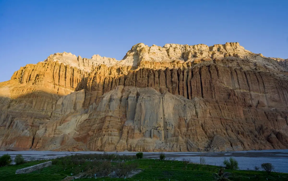
Layered rock cliffs under a blue sky near Lo Manthang, Nepal Amir Shrestha / Pexels
We leave the walled city and begin the return by a different path, on the eastern side of the Kali Gandaki. About six hours of walking cross a high ridge with sweeping views over Mustang, then drop to the village of Dhi, in a valley of green fields after the bare slopes. A last stretch climbs to Yara, at 3,530 metres, a village of distinctive mud houses and ancient cave dwellings, set among eroded cliffs that look like organ pipes. From here on, the route feels different from the way out. You sleep in Yara.
Day 14 Luri Gompa and Tashi Kabum, the painted caves
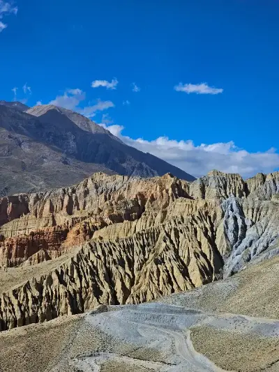
Eroded red rock formations under a blue sky in Lo Manthang, Nepal Deekshyant / Pexels
A round trip of about five hours from Yara, and the cultural high point of the journey. Luri Gompa is a cave monastery carved into the cliff face, famous for its Buddhist murals and domed interior; its age is debated, and it is often placed around the 13th or 14th century. Up the same valley lies Tashi Kabum, a smaller hand-carved cave whose frescoes are remarkably similar in style. Entering these small rooms after the empty landscape outside is something you do slowly, letting your eyes adjust to the colours. In the evening we return to Yara, where you sleep.
Day 15 Yara to Tangge (3,240 m)
Rolling hills and winding trails in Upper Mustang, Nepal Ashok J Kshetri / Pexels
A long day of about seven hours, across high passes and dry riverbeds where the only sound is often the wind. Few trekkers come this way, and that is the appeal of this side of Mustang: a walk with wide spaces and little passing traffic. The destination is Tangge, at 3,240 metres, a remote and beautiful village of chortens and mani walls. Pace yourself, carry plenty of water and enjoy the sense of distance, as there are few places to stop along the way. You arrive tired, and glad of it. You sleep in Tangge.
Day 16 Over Paha Pass (4,200 m) to Chuksang (about 3,000 m)
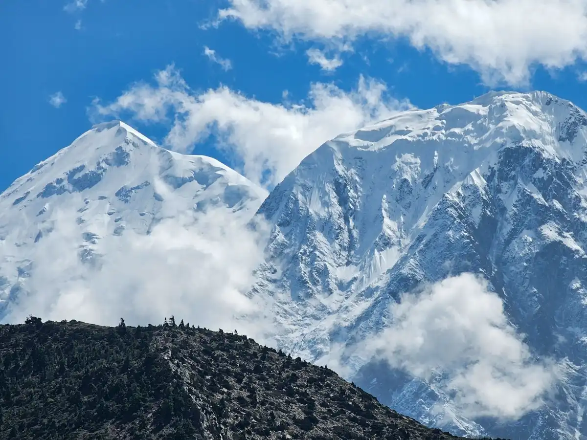
Snow-covered Himalayan peaks with clouds, Nepal Sagar Gnawali / Pexels
The longest walking day of the trek, at about nine hours, and the highest point of the route. Ancient paths climb to the Paha Pass, at 4,200 metres, before a long descent to Chuksang, at about 3,000 metres, where the trail rejoins the one you walked on the way in. It is a demanding day that calls for an early start and a steady rhythm rather than speed. Reaching the village again gives a strong sense of the circle you have drawn across Mustang, and you have well earned the rest. You sleep in Chuksang.
Day 17 Gyu La (4,050 m) and the sacred Muktinath (3,670 m)
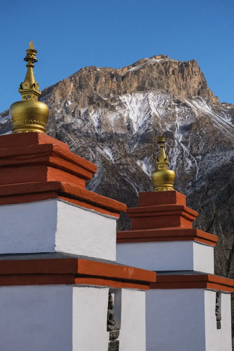
Stupas at Muktinath against the Himalaya, Nepal Mash Babkova / Pexels
About six to seven hours of walking lead up to the Gyu La, at 4,050 metres, with stunning views of Dhaulagiri, Annapurna and Nilgiri. On the far side lies Muktinath, at 3,670 metres, a temple sacred to both Hindus and Buddhists and a pilgrimage destination for each. Here you can see the 108 water spouts, where pilgrims bathe in spite of the cold, and the eternal flame, which burns from natural gas. After so many days of Tibetan monasteries, the shared faith of this place offers another way of seeing the Himalaya. You sleep in Muktinath.
Day 18 Muktinath, Kagbeni and Jomsom (2,700 m)
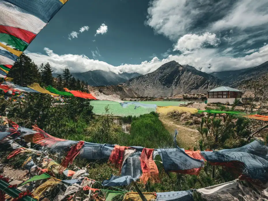
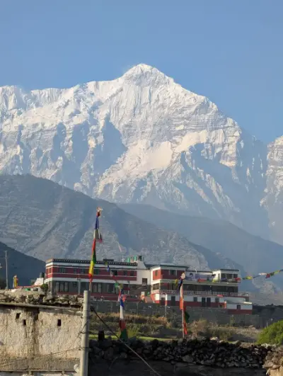
Colourful prayer flags and mountains in Jomsom, Nepal Ajay Lamichhane / Pexels
The last day on foot, about six hours of walking. A final descent through arid landscapes and villages takes us back to Kagbeni, where the loop closes, the same village where you stood on the threshold of Upper Mustang two weeks ago. We then follow the bed of the Kali Gandaki to Jomsom, at 2,700 metres. Reaching the end of the trail is a quiet moment as much as a joyful one, after fifteen days of walking in the old Kingdom of Lo. We celebrate the end of the trek. You sleep in Jomsom.
Day 19 Flight from Jomsom to Pokhara
Reflections on Phewa Lake in Pokhara, Nepal Subash Thapa / Pexels
A short mountain flight carries you back to Pokhara, and in a few minutes the high desert gives way to green hills and the warmth of the lowlands. Flights on this route depend on the weather, so the schedule stays flexible. The afternoon is free, and after more than two weeks on the trail it feels well earned. Sit in a lakeside cafe, book a spa treatment or take a boat out on Phewa Lake, with the mountains you have just walked beneath now far on the horizon. You sleep in Pokhara.
Day 20 Spare day in Pokhara
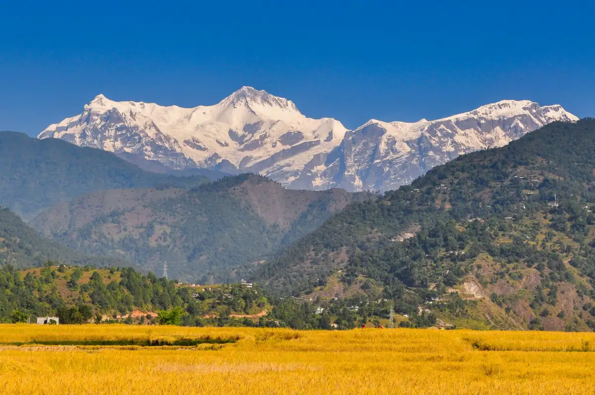
Snowy Annapurna range above golden fields near Pokhara, Nepal Nishess Shakya / Pexels
This is a buffer day, and in the Himalaya a buffer day matters. If bad weather has grounded the flight from Jomsom, this is when we make up for it, with a jeep ride as the alternative. If everything has gone to plan, the day is yours. Hike up to the Peace Pagoda for a view over the lake and the Annapurna range, book a massage for tired legs, or for something livelier try paragliding or zip-lining, optional activities at your own expense. Or simply do nothing, and let the journey settle. You sleep in Pokhara.
Day 21 Return to Kathmandu
Market street with vendors and shoppers in Kathmandu, Nepal Roman Saienko / Pexels
Today we travel back to Kathmandu, by flight or by road. The contrast is strong: after weeks of silence, wind and bare rock, the traffic and colours of the capital can feel almost overwhelming, and that is part of the journey too. Your final hotel is in Thamel or the Boudha area, close to the great stupa if you prefer quieter evenings. The rest of the day is free for souvenir shopping among the workshops and stalls, and for a farewell dinner to share stories of the trail. You sleep in Kathmandu.
Day 22 Free day in Kathmandu
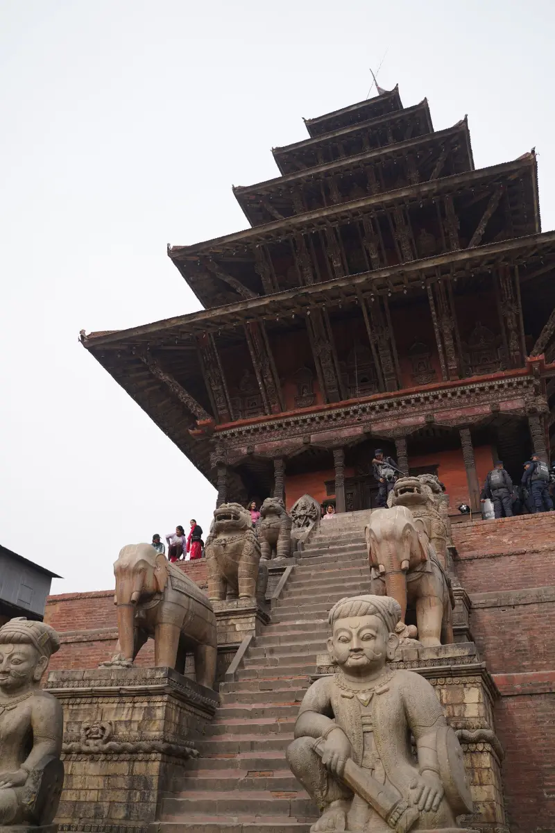
Nyatapola Temple with stone statues in Bhaktapur, Nepal Sushant Bista / Pexels
A free day, which also works as a last buffer if any part of the return has been delayed. Kathmandu has plenty left to discover at your own pace. The Garden of Dreams offers a calm, green pause from the noise of Thamel, while the Asan market shows the city at its busiest, among spices, grains and small shrines tucked between the stalls. For those who wish, yoga or meditation are a gentle way to close the journey, available as optional activities. Take your time, and think about what you are carrying home. You sleep in Kathmandu.
Day 23 International departure
Swayambhunath Stupa with prayer flags in Kathmandu, Nepal Mr Dr3igeteilt / Pexels
The last morning in Nepal. At the agreed time you are transferred to Tribhuvan International Airport for your flight home, and it is time for the final goodbyes. From the plane, if the sky is clear and you are on the right side, you may catch one more glimpse of the snowy peaks to the north, somewhere behind them the dry valleys of Mustang. Twenty-three days ago this was only a name on the map. Now it is a set of places, faces and silences that stay with you for much longer than the trail did.

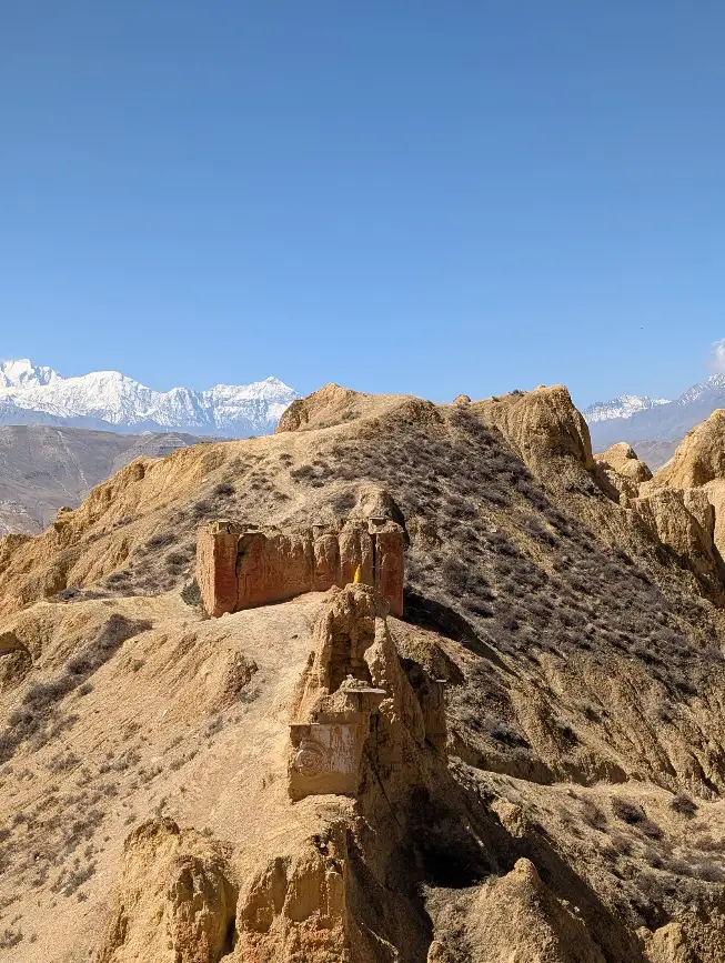
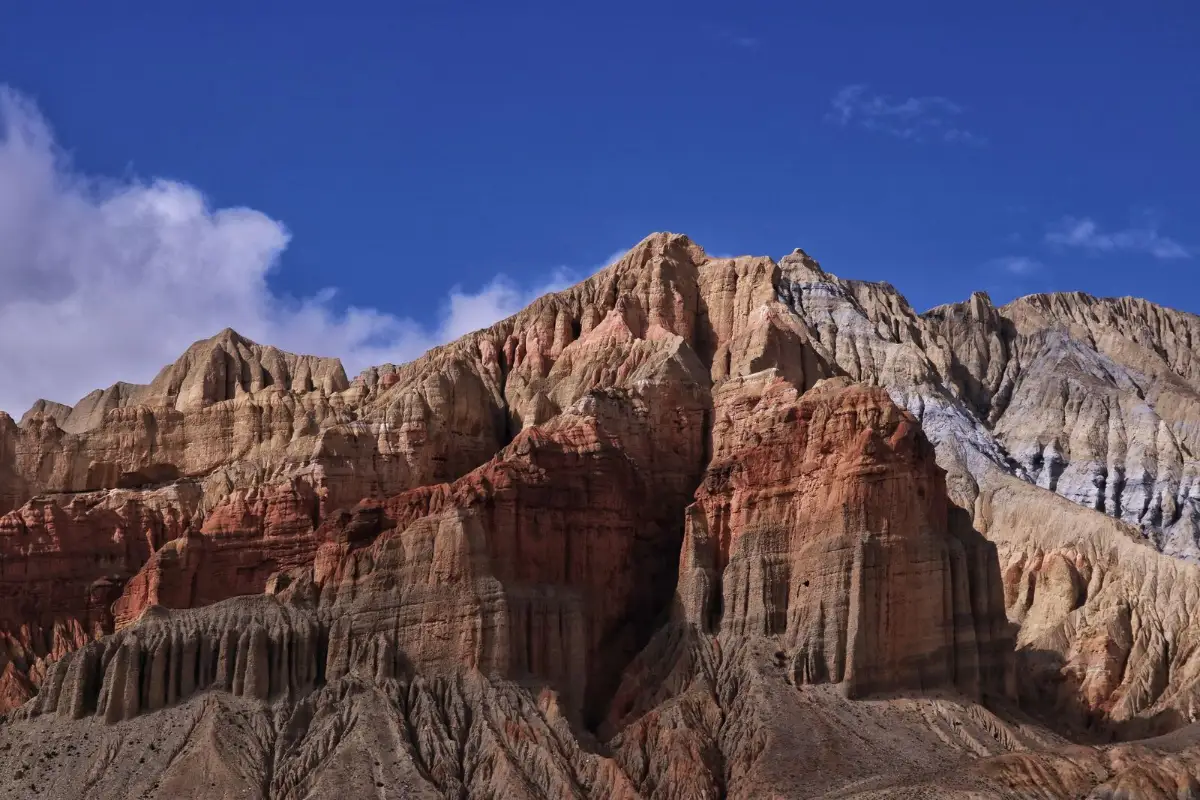
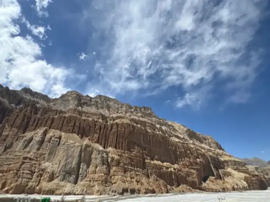
Huge rock formation under a deep blue sky in Mustang, Nepal
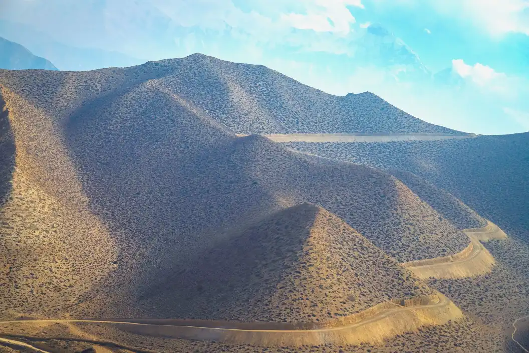
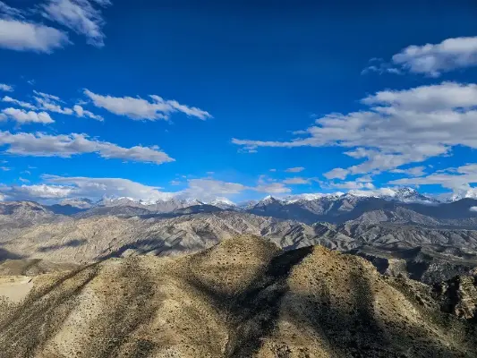
Mountains under a clear blue sky in Lo Manthang, Nepal
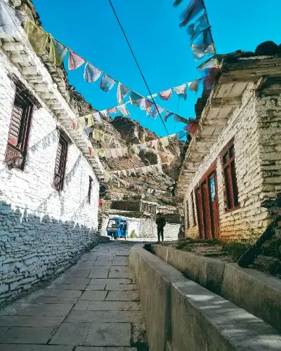
Village path with prayer flags between white houses, Mustang, Nepal
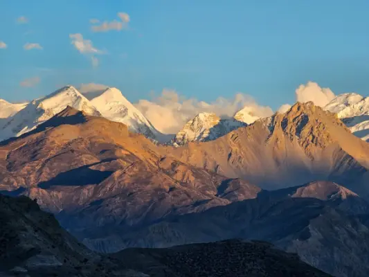
Himalayan peaks in golden light at sunset, Nepal
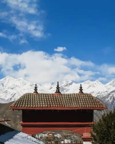
Traditional roof before the snowy Himalaya in Muktinath, Nepal
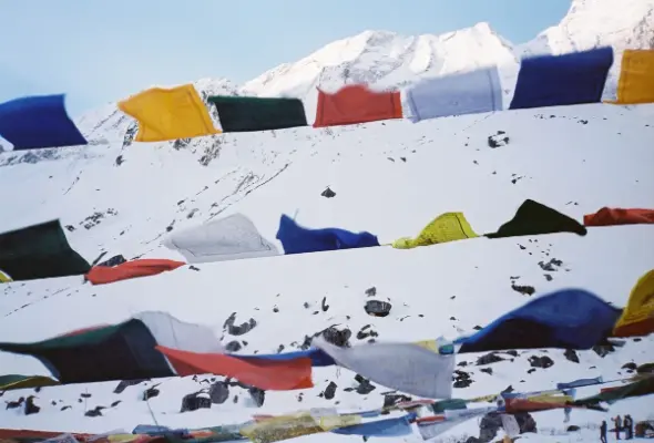
Prayer flags in the snow in the Annapurna mountains, Nepal
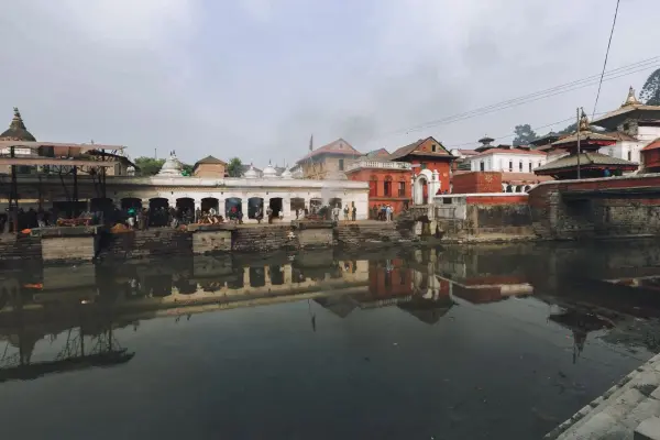
Pashupatinath Temple reflected in the Bagmati River, Kathmandu, Nepal
Traditional architecture of Patan Durbar Square, Nepal
Monastery in Nepal with the Himalaya behind
Dramatic rock formations under a blue sky in Mustang, Nepal

Included
Hotel in Kathmandu with breakfast
Guided visits to three cultural heritage sites in the Kathmandu Valley
Upper Mustang special trekking permit
Licensed, trained English-speaking local guide
All hot meals during the trek
Guide costs: food, insurance, salary, equipment, transport and local taxes
All transport and internal flights during the programme
Not included
International flights
Insurance of any kind
Visa fees
Lunch and dinner in cities
Drinks
Tips
Optional activities (horse ride, paragliding, zip-lining, massage)

Frequently asked

How long is the Upper Mustang trek?+
This itinerary lasts 23 days from Kathmandu to Kathmandu, with 15 days of walking between Jomsom and Jomsom. The remaining days cover cultural visits in Kathmandu, the transfers to and from Pokhara and buffer days for weather.
How difficult is the trek to Lo Manthang?+
It is a demanding trek because of its length and altitude, not because of technique. Most days involve 4 to 7 hours of walking, with one day of about 9 hours, on dry, windy terrain. No climbing skills are needed, but you should be fit and used to multi-day hikes.
What is the maximum altitude of this Upper Mustang trek?+
The highest point is about 4,200 m, at the Paha Pass on day 16. You sleep lower, at altitudes up to 3,840 m in Lo Manthang. The gradual route through the first days of walking helps the body adapt.
Do I need a permit for Upper Mustang?+
Yes. Foreign visitors need a Restricted Area Permit to enter Upper Mustang beyond Kagbeni, and you cannot trek here independently without a licensed guide arranged through an agency. The special trekking permit is included in this itinerary.
What is the best time to trek Upper Mustang?+
Summer and autumn are the recommended periods for this itinerary. Upper Mustang lies in the rain shadow of the Himalaya, so it stays much drier than most of Nepal during the monsoon, though flights to Jomsom can still be affected by weather.
What is Luri Gompa and why visit it?+
Luri Gompa is a cave monastery carved into a cliff near Yara, known for its Buddhist murals and domed interior. It is often dated to around the 13th or 14th century, and it lies off the classic route to Lo Manthang, on the return path of this itinerary.
What happens if the flight to or from Jomsom is cancelled?+
The itinerary includes buffer days for exactly this reason. Flights between Pokhara and Jomsom depend on the weather, so day 20 in Pokhara and day 22 in Kathmandu leave room for delays, with a jeep ride from Jomsom as the alternative.
Is this a group trip or a private experience?+
It is a private experience, arranged for you on the dates you choose. Contact us with your preferred period and we will send a personalised quote.
Price on request
Contact us for a personalised quote
Questions? WhatsApp →